Introduction
Best parks in Gilgit: Gilgit is the capital city of Gilgit-Baltistan in Pakistan. The city is located in a vast valley near the junction of the Hunza and Gilgit rivers.
Gilgit is a popular tourist destination in Pakistan, serving as a base for trekking and mountaineering expeditions in the Karakoram mountain range. It has the highest and most beautiful valleys in the world. This includes Nagar Valley, Skardu, Ghizer Valley, Ghancha, Gilgit, Astore Valley, Shigar, and Hunza Valley. Gilgit was a major city on the Silk Road, used to transport Buddhism from South Asia to the rest of Asia. Kashmir is considered a “Buddhist corridor” since many Chinese monks traveled there to learn and propagate Buddhism.
Best parks in Gilgit
Naltar Valley
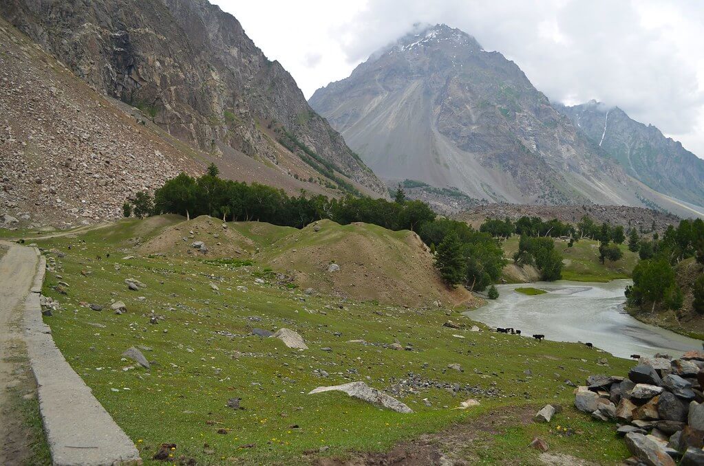
It is undoubtedly the most popular valley in Pakistan among adventurous people. A jeep ride is the ideal way to get to this valley, which is bordered by the ice-capped Hindukush mountain range, alpine trees, and lush green meadows. It is 35 kilometers from Gilgit at an elevation of 10,000 feet above sea level.
At Namal Village, the Resham Highway divides from the road that leads to Hunza from Gilgit. Then it progressively turns uphill. The higher Naltar pastures are the finest place to escape Gilgit’s harsh climate. Enjoy the valleys. They are waiting for you. Enjoy sips of tea in a little café during the nice weather. It is the starting point for reaching Naltar Pass (4200 meters above sea level), Ishkoman Pass (4800 meters), and Daintar Pass (15,700 feet). The entire valley awaits trekking enthusiasts.
Sky Resort is another wonderful option. The Pakistan Air Force (PAF) organizes winter sports every year. Players from all around Pakistan come here to compete. There is also a chairlift. This 19-kilometer-long valley contains four lakes. It is recommended that you accompany a local guide on your tour of this region. Enjoy the 12-kilometer trip.
Camping is permitted at both the first and fourth lakes. Book a jeep for the upper Naltar. This is because the Upper Naltar occurs after the Lower Naltar.
Fairy Meadows
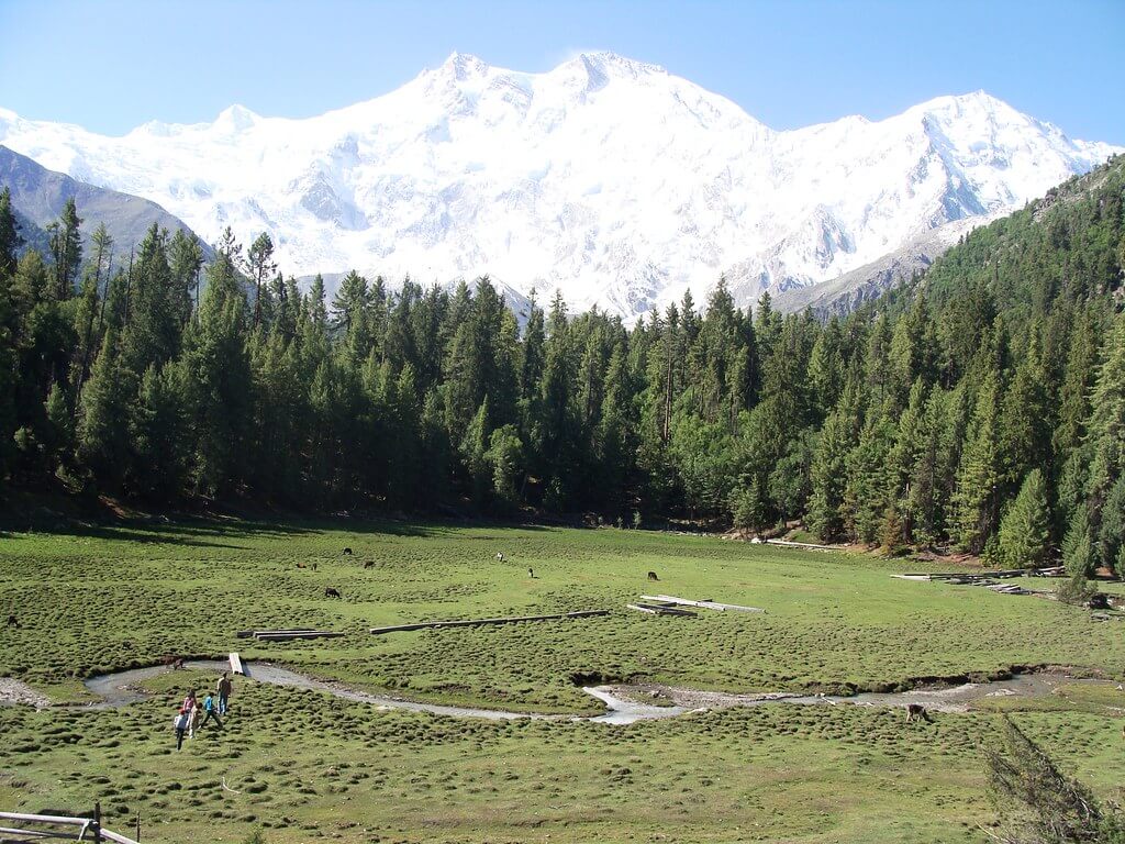
Fairy Meadows is the center of North Pakistan, known for its magnificent lush green plateaus. Nanga Parbat (the Killer Peak), the world’s ninth-largest peak, is located in the Diamer District of Gilgit-Baltistan, Pakistan. At 3,300 meters (10,826 feet) above sea level, the broad grassy meadow surrounded by lush alpine woodland is supplied by waters from a glacier formed by the Nanga Parbat, the world’s ninth-highest peak (and second-highest in Pakistan, after K2), which towers over Fairy Meadows from the south. A wonderful setting made all the more wondrous by the perilous journey to get here.
Hermann Bhul, an Australian climber, dubbed the site Fairy Meadows in 1953 because of its enchanting beauty. He had come to ascend the top of Nanga Parbat. He became the first person to summit the mountain. Fairy Meadows is also known as “Heaven on Earth” because of its breathtaking beauty. The location, known as “Joot” among locals, was given the name Märchenwiese (roughly “Fairy Tale Meadows”) by German mountaineers who were undoubtedly surprised when they first saw this magnificent environment.
Fairy Meadows is accessible via a fifteen-kilometer jeepable trip from Raikot Bridge on the Karakoram Highway to the village Tattu (Tato). There is just one road to Fairy Meadows, and it isn’t your typical difficult mountain road; in 2013, the World Health Organisation named it the second deadliest road on the planet. The treacherous and narrow gravel mountain road is solely open to locals, who carry guests from Raikhot Bridge to Tato. From Tato, it takes roughly three to four hours to reach Fairy Meadows via a five-kilometer hike. The grassland is located in the Rakhiot valley, near one end of the Rakhiot glacier, which originates from Nanga Parbat and feeds a stream that eventually falls into the River Indus
Taj Mughal Monument
The 700-year-old Victory Monument of Taj Mughal serves as a commemorative tower with a commanding perspective over Gilgit. It stands 21 feet 10 inches tall and 14 feet 4 inches wide. The monument is placed on a high slope in Gilgit town, offering amazing views of Gilgit and its surroundings. It was called after Taj-ud-Din Mughal, an Ismaili monarch from Badakhshan who landed in Gilgit-Baltistan in the 13th century. His warriors raised the monument to commemorate his victories. Visitors can walk to the monument from Jutial, near the Serena Hotel, to take in the spectacular views of Gilgit.
Rakaposhi View Point
The Rakaposhi View Point demonstrates nature’s unsurpassed splendor. The viewpoint is located in Ghulmet village, along the main Karakoram Highway, in the picturesque Nagar Valley. This amazing vista provides an up-close and intimate interaction with the breathtaking Rakaposhi mountain. The Karakoram Highway is more than just an asphalt artery connecting Pakistan and China via the Khunjerab Pass. It’s a roadway ornamented with a plethora of tourist attractions. The highway is home to natural beauties, archaeological marvels, cultural riches, and architectural splendors. It entices visitors to stop and immerse themselves in its appeal. Rakaposhi View Point, located along this route, stands out as a prime example of pristine natural beauty.
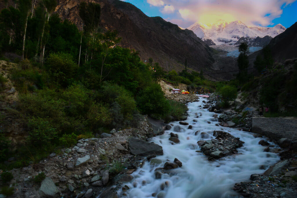
When traveling between Gilgit and Hunza, seasoned travelers make a required halt at Rakaposhi View Point. Rakaposhi’s shadow is the world’s 27th tallest peak, reaching 7,788 meters. Here, one can find comfort and delight amid unparalleled natural magnificence. Furthermore, the location features modest terraces thoughtfully created along the glacier-fed stream, inviting visitors to unwind, eat wonderful food, and take in breathtaking views.
During the summer, travelers enjoy relaxing by the stream and soaking their feet in the delicious glacier water. Furthermore, this spot is great for capturing the scenic surroundings with their lenses. The symphony of rushing water, the verdant embrace of nature, and the grandeur of Rakaposhi provide an amazing experience.
Rakaposhi View Point has made an incredible journey from obscurity to acclaim. The progressive increase in tourist traffic contributed to its growing significance, which in turn fueled infrastructural development in the surrounding area. The park has a variety of attractions, including a glacier wrapped in vegetation and a meandering creek that creates a nice breeze.
Rakaposhi View Point was once nothing more than a small gift shop and a modest café that catered primarily to nearby tourists. Local merchants eventually took advantage of the opportunity, opening gift shops, handicraft stores, convenience stores, restaurants, campsites, and even upmarket visitor lodgings. A new road has been built, allowing for easier access to the glacier coming from Rakaposhi, and plans are ongoing to build more tourist attractions. The future holds the prospect of making this location a top tourist attraction.
Kachura Lake
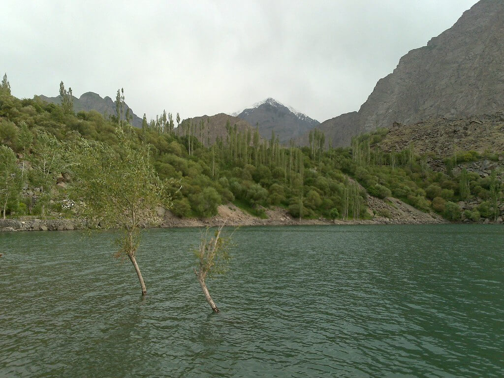
The term “Kachura Lake” (Urdu: کچورہ جھیل) refers to three lakes in Skardu Valley. The three lakes are Upper Kachura, Lower Kachura, and the lesser-known Zambakha Lake. Upper and lower Kachura Lake is located at an elevation of 2,500 meters. Because of the rugged terrain, travelers rarely visit Upper Kachura Lake. Lower Kachura Lake, also known as Shangrila Lake, is a natural wonder in Pakistan’s stunning northern region. Zambakha Lake is located in the little community of Zambakha, near Shangri-la.
The lakes are located at various elevations in the Karakoram mountain range in the western Himalayas and the River Indus basin in Gilgit Baltistan. Kachuras is the most popular tourist destination due to its diverse flora, which includes western Himalayan subalpine conifer forests and wild apricot orchards (Prunus armeniaca).
Lower Kachura, also known as Shangrila, derives its name from the Tibetan language, where Shang is a place, Ri signifies mountains, and La means a route. The name was initially used by James Hilton, an English novelist, in his classic work “The Lost Horizon”. Hilton describes a jet that crashed near a riverbed. The monks who lived nearby transported the survivors of the plane disaster to a site named Shangrila. The location was described as a natural wonderland with breathtaking beauty and invigorating air.
Deosai National Park
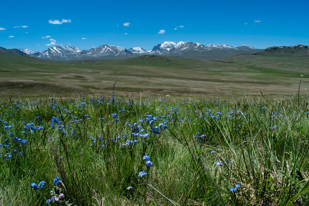
Deosai National Park is certainly one of the most spectacular spots to camp. Deosai, the world’s second-biggest alpine plateau, consists of seemingly unending grasslands covered in wildflowers. It covers more than 3,000 square kilometers and has an average height of over 4,000 meters. Greenery abounds in Gilgit-Baltistan, northwest Pakistan, near India. Deosai means ‘Land of the Giants,’ and it’s easy to see why as you look out over the endless green expanse. Deosai has so much to offer that it has earned a spot on our list of the best places to visit in Pakistan.
Kargah Buddha
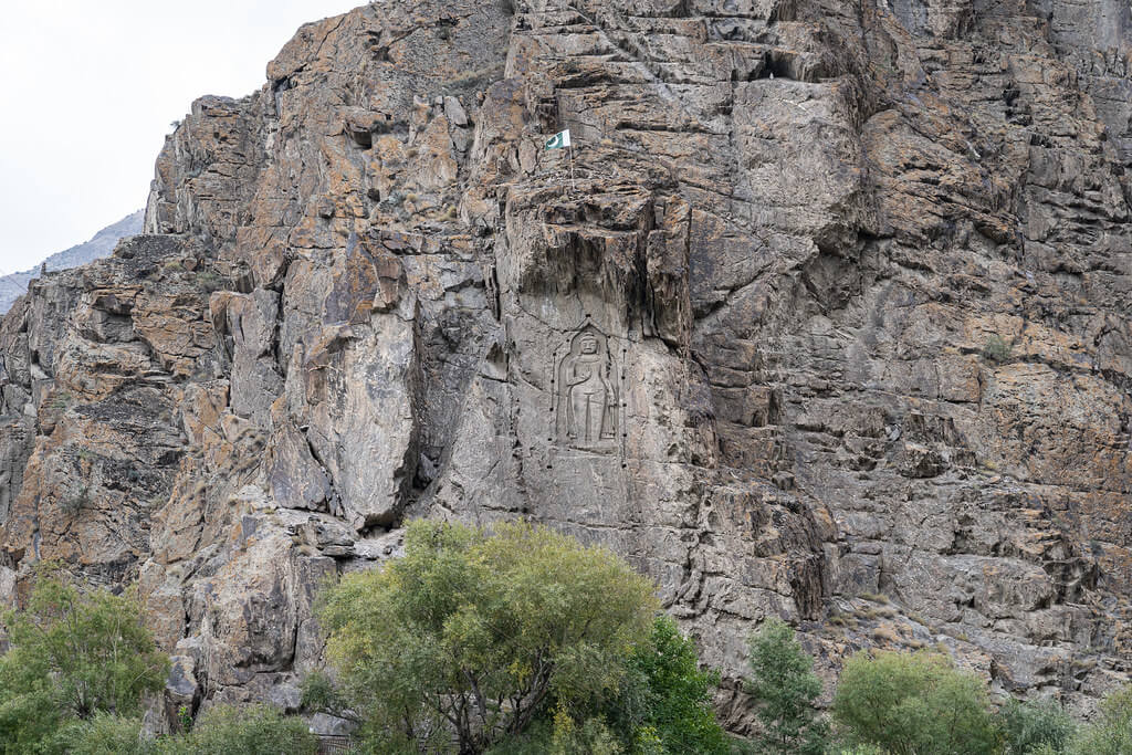
It is a rock sculpture in a ravine in Gilgit city, some ten km from the city center, that is seen by practically every tourist who visits Gilgit. Kargah is the name of a small hamlet on the outskirts of Gilgit city, and the carving was given the name Buddha because, according to the locals, it was carved by Buddhists in the seventh century and excavated by archaeologists in 1938-1939.


